MALA GROUND PENETRATING RADAR - GPR
  • PRODUCTS
    • MALA Products (GPR) >
      • MALA Easy Locator HDR
      • MALA Easy Locator PRO HDR
      • MALA Easy Locator PRO WideRange Dual Frequency
      • MALA Easy Locator Core
      • MALA GroundExplorer GX
      • MALA GPR GeoDrone
      • MALA CX12 Concrete Scanner
      • MALA 3D MIRA HDR
      • MALA 3D MIRA
      • GPR Processing Software
      • MALA Professional Explorer
      • MALA Rough Terrain Carts
    • ABEM Products >
      • ABEM Terrameter LS2
      • ABEM Walktem 2
      • ABEM Terraloc Pro
    • RadioDetection Products >
      • Radiodetection RD7200 / RD8200
      • C.A.T4 and GENNY
      • Radiodetection RD312
      • Radiodetection RD316
      • Radiodetection RD500
    • Trace Rods >
      • Vetter Tracing Rods
      • MSS Tracing Rods
  • Applications
    • Bedrock Mapping
    • Rail Corridor
    • Utility Detection
    • Concrete Scanning
    • Transportation & Infrastructure
    • Environmental & Geotechnical
    • Military & Police
    • Exploration & Mining
    • Education & Research
    • Archaeology
  • Consulting
    • GPR Data Processing
    • Underwater GPR
    • Cemetery Mapping
    • Environment
    • Infrastructure & Engineering
  • Training
  • Rental
    • RTK GPS Hire
    • Dualem Conductivity Meter Rental
  • 2nd Hand Instruments
  • Servicing
  • About Us
  • Contact

Easylocator

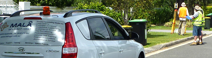
Utility Detections / Pipe & cable Locating

GPR for Utility Detection
Prior to the use of GPR, utilities constructed of plastic, terracotta, concrete, non-toneable fiber, asphalt composite and other materials were generally considered non-locatable. This stemmed from the fact that the generally accepted method of non-intrusive detection incorporated the use of electromagnetic devices which cannot locate non-metallic / non-conductive underground objects.
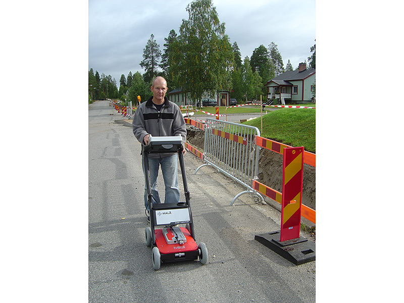
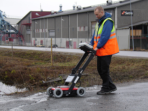
GPR became main-stream for utility detection and mapping when MALÅ Geoscience introduced the MALÅ Easy Locator in the early 2000’s. The Easy Locator revolutionized the use of radar, introducing GPR at a price point half that of other systems available at the time. The user-interface broke every barrier in terms of ease of use in the field and became the GPR standard and selected tool by locating professionals.

GPR for utility detection

Application includes:
  • Void location
  • Environmental remediation
  • Utility positioning & mapping
  • Utility detection
  • Damage prevention
GPR for utility detection
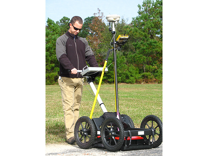
Taking locating to the next level, MALÅ Geoscience is pleased to introduce the GroundExplorer System as the standard alternative to the Easy Locator HDR for mapping and gridding. It’s the most popular system on the market today for use by Subsurface Utility Engineering firms for extensive mapping of industrial and commercial areas. With its rough, flexible and modular design, the system offers an easy to use and costeffective solution for locating and mapping professionals worldwide.For more advanced and larger scale projects MALÅ Geoscience rely on the high-end MALÅ Professional Explorer (ProEx™) and MALÅ MIRA 3D Radar System to offer a wide variety of solutions for the civil & structural engineering professionals. With the systems comprehensive hardware and user-friendly software our customers will save both actual operation time and man-time which makes the MALÅ GPR solution the reliable and cost-effective alternative.
REQUEST MORE INFO
Submit >

RELEVANT PRODUCTS:
EasyLocator HDR
EasyLocator HDR Pro
GroundExplorer
MIRA 3D GPR
RESOURCES:
ABCXYZ of EM Cable Locating
File Size: 2844 kb
File Type: pdf
Download File

Mala GPR Applications
File Size: 498 kb
File Type: pdf
Download File

Picture
Picture
Home - Products - Applications
​Consulting - Training
​GPR Rental

FOLLOW US

TELEPHONE

0401 058 562
0420 968 765
Privacy Policy
Copyright © 2009-2021 MALA GPR Australia  (ABN 78 132 266 678). All rights reserved.