GPR for Archaeology
Archaeologists worldwide apply the GPR method on projects to obtain non-invasive subsurface information from the Pyramids of Egypt to the rain forests of South America and everywhere in-between.
GPR provides archaeologist’s with a tool to image otherwise completely indistinguishable features from the surface.
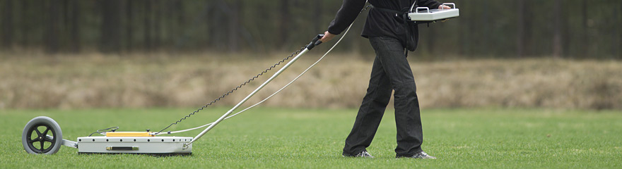
Buried trenches, burials, objects of interest, ancient foundations, and many other anthropogenic features in the subsurface are often initially discovered with GPR. Having preliminary information is essential for the archaeologist to focus their efforts and minimizes the need for blind or random test pits. MALÅ X3M and ProEx systems from MALÅ Geoscience offer ideal platforms for the archaeologist in projects covering small to medium areas.
Application includes:
The system and its array technique uses a number of transmitter and receivers simultaneously to measure several parallel profiles in one sweep and by doing so, the survey becomes detailed, accurate and extremely cost-effective.
In Australia and New Zealand Ground Penetrating Radar investigations are quite commonly used by archaeologists and geophysicists for the detection of indigenous (Aboriginal and Maori) unmarked graves. The Department of Environment and Heritage in New South Wales (NSW) in Australia has issued a guide for the evaluation and detection of unmarked graves. It is called “Lost but not forgotten – a guide to methods of identifying Aboriginal unmarked graves” (external link). It also desctibes various other geophysical methods such a Total Field Magnetics, Metal Detector Survey, EM conductivity, Electromagnetics and Soil Resistivity. You can also download the guide directely here: Geophysical methods for detecting unmarked graves (PDF 1.68Mb). MALÅ Object Mapper is ideally suited for picking targets of interest and immediately creating “dig sheets” or grid maps to scale. In the box 2.5D time slicing with the MALÅ Monitor XV11 provides the project scientists with near real time images with detail not always achievable with standard 2D profiles.However, for larger areas and where there is a need of very detailed subsurface information, it is most efficient to use a full-range 3D GPR Array system, such as the MALÅ MIRA System. |
REQUEST MORE INFO
RESOURCES:
| ||