Mala GPR for Infrastructure & Engineering researchbACKGROUNDThe developed nations are facing a huge challenge....Some might even call it a ticking time bomb. Over several decades there has been an under investment in new infrastructure and repairs have been executed ad-hoc in response to failures rather than as a part of systematic preventative maintenance. A large proportion of the physical infrastructure assets is now way past their expected life and still utilised to over 100% of their capacity. This is true for many types of assets such as water supply lines, sewers, canals and roads. With the number of people now occupying the cities the consequences of infrastructure failure are significant. Obviously there is the physical damage and cost of repairs, but the breakdown of infrastructure has the potential to threaten productivity and have huge financial ripple effects in society. What really is our asset?Many nations are starting to wake up to the reality that something needs to be done and investments are more forthcoming. But, there is a problem...... In order to invest in maintenance and upgrades you need to have a clear plan for what quality level you want to achieve. Once this is defined you evaluate what investments are required to lift the assets from the current level to the desired level, and therein lies the problem. Many assets are now more than 100 years old and no construction plans exist. Some information might be retained from discrete invasive investigations but generally the asset owners have very little idea of the condition of their network and in some cases they don’t even know where their subsurface network precisely is located. So the first part of any infrastructure investment is to obtain clear, continuous information about the current location and condition of the infrastructure and THIS is where geophysical methods can assist. Geophysical solutions to engineering problemsGeophysics can provide unique opportunities for identifying and mitigating the vulnerabilities of the key assets and critical infrastructure that keeps our society and
economy functioning. Geophysics can aid in the in the assessment and targeting of maintenance of old or damages assets. Geophysics can also obtain information about a site prior to development thereby mitigating risk, avoiding hazards and providing a basis for informed decision making. An efficiently performed survey can cover large areas quickly, gather quality information which can be provided in CAD suitable format and positioning using high accuracy GPS positioning. Detailed subsurface site information obtained through geophysical investigation can quickly and accurately identify the locating of ground and structural anomalies, allowing civil and structural engineers to optimize budgets, avoiding potential incidents, minimize finical losses, risk to human life and risk to the environment. Typical Applications Include
|
REQUEST MORE INFO
|
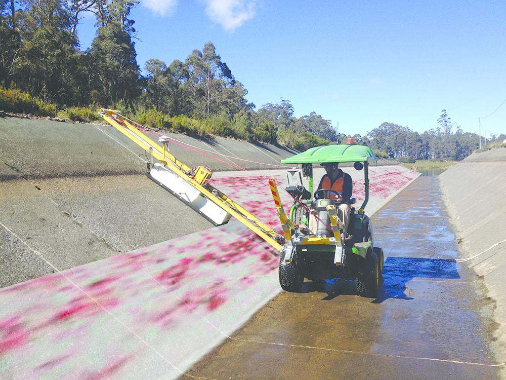
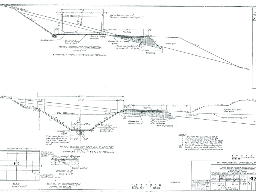
CASE STUDY ONE: HYDRO CANAL MAPPING, TASMANIA
During construction of a new taxi-way at Melbourne Airport some timber material was inadvertently mixed in with the granular
component. It is believed the timber material consists of tree roots which were crushed with the rock when it was recovered from the quarry. Since the tree roots were crushed with the rock during the quarry processing is believed the size of the roots are in the same order as the rock material. The presence of shallow foreign objects within the concrete slab constitutes a significant risk as it can potentially become detached and be sucked into an aircraft engine.
|
|
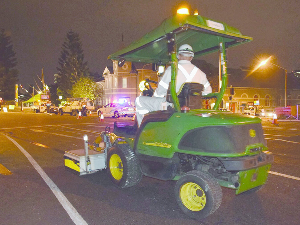
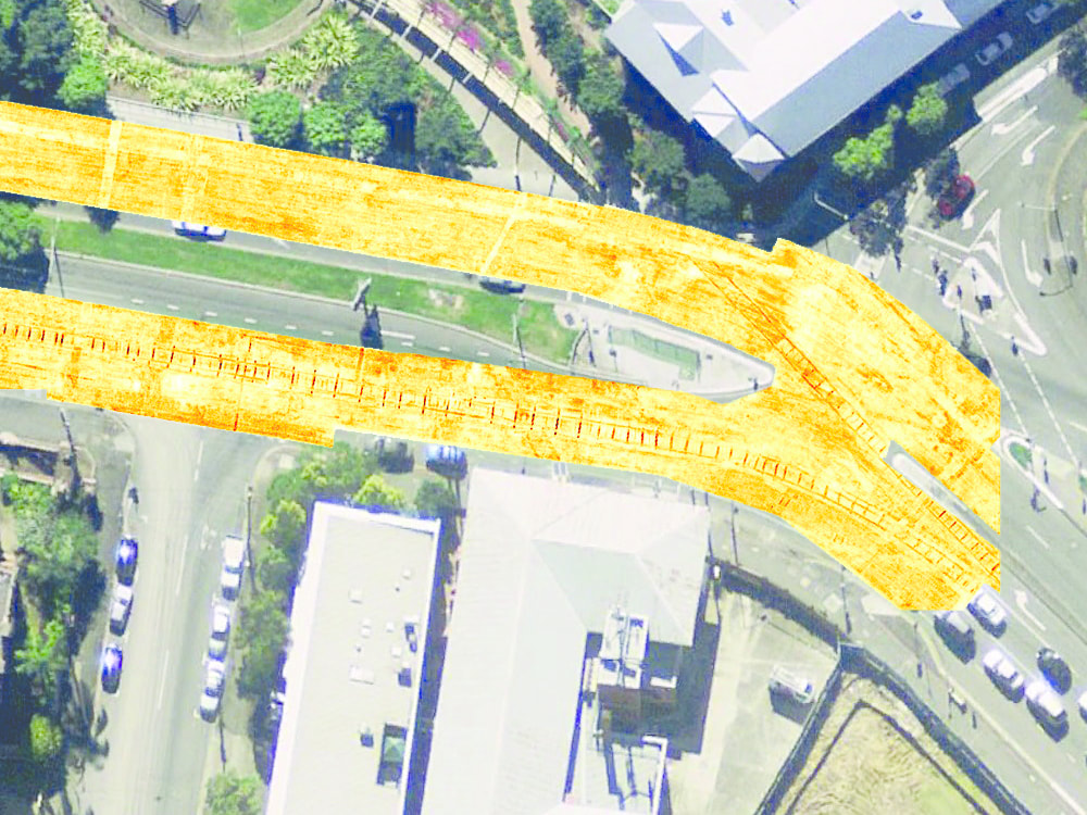
CASE STUDY TWO: ROAD SCANNING, BRISBANE
During the construction of Mater Hospital in Brisbane a deep road profiling was required to level the new access road. MALA GPR was engaged to map all sub-surface structures which could interfere with the 250mm deep road profiling operating.
During the construction of Mater Hospital in Brisbane a deep road profiling was required to level the new access road. MALA GPR was engaged to map all sub-surface structures which could interfere with the 250mm deep road profiling operating.
|
|