GPR for Exploration & Mining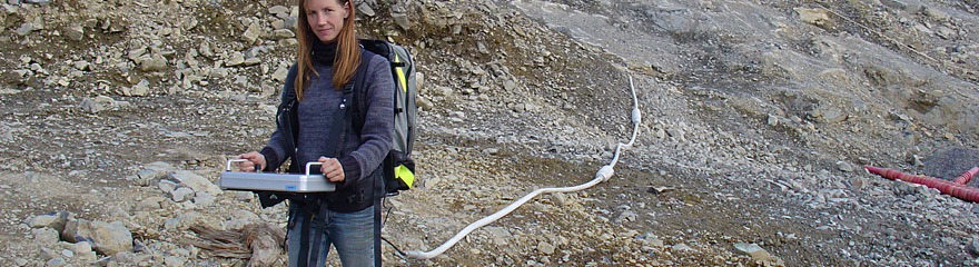
Geologists and geophysicists rely on ground penetrating radar (GPR) to gather high resolution subsurface information rapidly.
Compared to other geophysical methods nothing comes close in terms of the amount of ground coverage that is obtained with GPR.
Several kilometers of terrain may be surveyed and with integrated GPS geological mapping and prospecting in remote regions is easily accomplished. Antennas ranging from low frequency MALÅ RTA antennas up to the higher frequency MALÅ shielded antennas are all applicable depending on the degree of resolution and the depth of penetration desired. Application includes:
MALÅ Geoscience offer suitable solutions for geological or mining applications in both the MALÅ ProEx and MALÅ X3M system configurations. The flexibility in the MALÅ GPR Systems allows antennas to be pulled by hand or towed in various configurations behind ATV’s, vehicles, snowmobiles, or whatever other means is necessary to traverse the desired terrain. GPR is frequently used to obtain the following geological information:
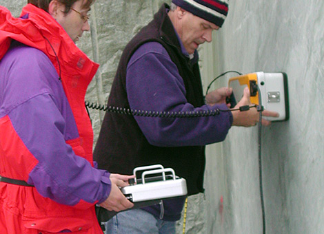
Using borehole radar
The need of knowledge of subsurface conditions are in many cases vital to make the right decisions concerning underground constructions, hydrogeological models, estimation on volumes of different earth material etc. When using borehole radar as an investigation tool in front of constructions in mine shafts, valuable information on what fractures to meet and by that the risk of flooding of the construction site is gained. To drill boreholes (horizontal to vertical) prior tunneling work and carry out borehole reflection measurements can in many cases be the only way of estimating how to continue the construction and in which part precautionary measures should be taken. |
REQUEST MORE INFO
RESOURCES:
| ||||
|
|